
by admin | Mar 25, 2012 | 2012, Talks
Speaker: Peter Berning
This bit of trouble that I got into began at UCT (Smuts Hall, 1968). Iain Buchan and I were new men together and both products of the Transkei, where our parents ran medical practices in Lusikisiki and Cofimvaba respectively. We remained friends and in frequent contact. Following my experiences in the Arctic, Iain (Buch) asked me in 2009 what I thought would be a “next on the bucket list” experience. I said that Antarctica beckoned and there was a mountain – one of the seven summits – Mt Vinson – that we would climb. He began investigating; and following discussions with his sons Zack and Barney decided we would tackle ‘The Last Degree’ instead: a plus/minus 120km ski to the South Pole from 89 degrees south, pulling our gear on sledges.
I had openly told Buch that I would need to be sponsored and that if a charity or worthy cause could benefit from our expedition it would be more fulfilling. He concurred and reassured me on both counts.
So it was that on 9 January 2012 (this year) we flew out of O. R. Tambo for Sao Paulo Brazil to connect to Santiago (Chile) and on to Punta Arenas at the southern tip of Chile on the straits of Magellan where we arrived at 5a.m. on 10 January 2012. Our party consisted of Iain, Zack and Barney Buchan, Nzuzo Mtikati (representing our charity – The Unlimited Child) and me, as well as the seasoned adventurer and documentary photographer Sean Wisedale. We met the organizer from Adventure Peaks – Dave Pritt, and Rob (who was to ‘navigate’) at the hotel – ‘The Mundo Dreams’ – a 4-star establishment overlooking the straits.
The next two days were spent organizing kit, buying last minute extras and experiencing the quaint bustling little town. Following an orientation lecture by staff of ANI (Adventure Network International) who control and run Union Glazier to which we were flying, we were told to await the call to board the Iluyshin-76 waiting on the Punta Airport runway for favourable weather in Antarctica.
The call came that very evening and by 10pm we were airborne in the huge cargo jet – only 27 seats and the rest of the fuselage cordoned off for cargo – no windows – very noisy and with a very calm and friendly crew. We landed on the 3 mile blue ice runway deep in Antarctica at 2am and were transported the 9km to Union Glazier base which has replaced the previous well known Patriot Hills as the ANI base.
This efficient base, with excellent food, a warm dining area, 24-hour communication room, a Clinic with two doctors and tented accommodation would be our orientation and training base for 2–3 days as we prepared ourselves and waited to be flown to 89 degrees south from their smaller airfield. One short trial ski and one night out from base, near a beautiful glacier, was the limit of our training; and on the 15 January 2012 at about midday we flew out in a turbocharged recon Dakota (DC3) – now called a Basler – piloted by two Canadians out of Calgary where Ken Borak Air is based.
This fleet of aircraft work the Arctic from March to September; then ferry south to service Antarctica in its summer. We landed at 89 degrees south at 3.30pm and offloaded our gear, forming a chain and piling our sledges and skis away from the prop wash. Then watched the Basler take off, leaving us alone on the vast polar plateau, with our next sighting of humanity at the South Pole. We did a short 3 hour pull covering some 5-6km before making our first camp on the ice.
I will now try to describe a day in the life of a Polar traveler starting with the intense light on dilated pupils as one lifts the eye cover that has been used to shut out the 24-hour sunlight. It is about 6am Chile time and it will take up to three hours to be ready for the planned 9am start. The temperature in the tent is a warm minus 8 degrees as the wind has been mild and the yellow inner tent has trapped some sunlight heat and retained our body heat. Removing the thermal underwear and reaching into my sleeping bag, I start to dress in layers that could reach up to four below the waist and up to five above. Ablutions are performed as I exit my sleeping bag – peeing into a bottle and spitting toothpaste and saliva into the same. This will be poured into our ‘grey hole’ at the campsite which will be covered when we leave camp.
Peeping outside to assess the weather and wind before deciding on upper body layers for the day and whether to use the wind suit or not, I see steam issuing from the mess tent some 7 metres away as ice is melted and heated for breakfast. Then back inside to pack the sleeping bag, roll up the thermorest and foam ‘mattress’ and feeling the temperature drop 5–10 degrees as the insulation is packed away. Extra gloves, toiletries, diaries and nightwear are packed into various bags which are tossed out into the snow/ice awaiting the packing of the sledge. We go over to the mess tent to sit tightly together in the steamy but icy tent that has been pitched over a trench some 2,5m by 1m wide. We sit facing one another with our legs and feet in the trench. Breakfast is porridge and scrambled egg with small ham cubes both prepared by adding boiling water to the dehydrated food packets and waiting 5-to-8 minutes before eating. Coffee and tea and the filling of our all-important thermos flasks involves the melting of much ice and we exit the mess tent one by one, our flasks full and snacks (trail mix, chocolate or sweets) packed in the grab bags from which we will eat all day.
The tents are struck and rolled up – with the poles coming apart with some difficulty due to freezing at the joins. The sledges are packed as neatly as possible; boots secured; harnesses on and clipped to the tow ropes; skis on; and then the all-important ‘buddy check’ as you check each other for face mask placement, hoods and goggles – covering every centimetre of cheeks and neck.
We group together to discuss the pace, stopping times and estimate for the length of the day. The plateau is nearly 9500 feet above sea level and flat all the way to the Pole. Barney had nausea and a headache from mild altitude sickness but responded well to treatment. We set off just after 9am, navigating by compass, the sun, our shadows and with intermittent GPS checks. We decided on one-and-a-half-hour sessions of trekking with 10-to-15 minute breaks to rest, eat and drink. It is a good idea to turn the sledge, at each stop, backs into the wind and pulling up close together, sitting on the sledge for a few minutes rest, chat, drink and snack.
It is vital to put the big fleece jacket on immediately after stopping; and to limit the time that your hands are out of the mitt, as cold fingers take up to half-an-hour to warm up (even with the warmers waiting in the mitts). After three sessions it is past 2 o’clock. We have covered more than 10km and decide on a 5 – 5.30 stop. Scott (our American guide) has struck the mess tent and cleaned the campsite. After kite skiing for a couple of hours he has caught up and passed us on the snowmobile and given instructions to make camp some 6 – 7 km ahead. We soldier on for two more sessions with the second being a very short stop as we can see camp up ahead. We get into camp before six, tired but not exhausted and head to the mess tent for soup or hot chocolate. This is a mistake as we must now leave the shelter and relative warmth of the mess tent and go out to pitch our own tents – this is not pleasant. It is bitterly cold (about minus 30 degrees), the wind is quite stiff and we are tired. We decide there and then to get the tent up and ready for bed before we go for soup etc. in future.
Food is ready around 8pm and by 8.45pm we are back in our tents and in our sleeping bags. Buch is asleep by 9.15pm but I lie awake till 10pm enjoying the comfort and warmth of my sleeping bag before pulling my beanie over my eyes and drifting into a Polar sleep.
I am awake at 5.30am but reluctant to move yet. Buch is bravely contemplating his first Polar toilet visit. Into a wag bag, out on the tiny loo, with minimal protection from the wind! All waste must be kept in the bags provided, 2 poos per bag (your own), and taken to the Pole for eventual disposal in Chile!!! Only urine and cooking waste may be poured into the ‘grey hole’. Buch returns cursing and we decide to dig a trench under our fly sheet up to the tent flap ‘door’, creating a step outside the tent protected from the wind by the flysheet. This was a far better place for wagbag use. It was also useful for putting on and taking off our boots. The boots come inside at night to be hung upside down above us with gloves, face mask, and anything vaguely damp – amazingly, all these were dry in the morning due to the low humidity. The polar plateau is a high dry white desert with very little snow.
On 17 January we commemorated the centenary of Robert Falcon Scott’s arrival at the Pole some 35 days after Roald Amundsen. In a filmed interview with Sean Wisedale, Zack mentioned the incredible tenacity and bravery of the early polar explorers – comparing the technology and quality of equipment we now had at our disposal to that of a century ago. He noted however that the conditions and climate are no less brutal now and demanded constant vigil or it would ‘bite you on the bum’. This proved to be an unfortunately true prediction as Nzuzo was found to have cold damage to his nose and two fingertips, undoubtedly due to inexperience, poor diligence and possibly inadequate training. We decided to confine him to camp and to have him travel by snowmobile with Scott, as the damaged areas were extremely vulnerable and further cold exposure would result in frost bite and loss of terminal digits etc. Nzuzo accepted the decision in good spirit, and rejoined the trekking three days later.
We peeled off the days getting stronger and a little faster and were lucky to have no high winds to confine us to the tents for the seven days we were on the plateau. This is unusual as there is usually a ‘big blow’ every 5–6 days. By the evening of 20 January we could see the two large structures that house the telescopes and other equipment at the South Pole, looking like ships on a white sea. We were about 20km away. On 21 January at about 4pm we arrived at the beacon some 4km from the South Pole at which all ‘traffic’–skiers, racers, vehicles – must enter the area surrounding the Pole. This is essential for control of the runway, clean air zones, scientific areas etc. We then vectored down a dedicated marked route to the camping site, about one kilometre from 90 degrees south. The last 4km was an absolute killer after the understandable celebrating at the yellow beacon sign which read “Welcome to the South Pole”.
Nevertheless at 5.30 pm we were welcomed by the ANI crew who were dismantling the structures which had been erected for the Amundsen and Scott Centenary events. We had a shot of whiskey (called HIGH COMMISSIONER – which I had never heard of) and a hot stew with bread – then pitched our tents and headed for the ‘visitors centre’ which had two big gas fires, comfortable camp chairs and a ‘relatively’ warm loo. Indescribable luxury!!
I read some passages from Scott’s dairy of 17 January 1912 to the team and we all fell silent – aware of the fate that was to befall them, and the vast difference in our privileged state.
The weather was still good and the Basler was due in the next morning. We returned to our tents to sleep. We then had just enough time to pack and have a short one-hour tour of the massive American base the Amundsen Scott Base – guided by a delightful lady from the Midwest – before the obligatory photographs at the commemorative Pole (the ‘barbers’ pole, with 12 national flags – South Africa’s among them) in a circle around it. The smaller True South Pole is some 60 metres away at 90 degrees exactly and with only a modest sign beside it.
We walked the kilometer back to the plane (waiting right near the campsite) into a biting wind of 30 km an hour – creating a temperature of minus 42 degrees C which was vicious on any exposed skin–yet twice I had to tell Nzuzo, who was walking beside me, to cover his nose. It was as if he still didn’t ‘get it’. You don’t mess with extreme conditions!
By late afternoon we were at Union Glacier – appreciably warmer than the high plateau – and with snacks and Chilean champagne laid out on a table outside. Very impressive! As was the meal laid on inside …..congria and vegetables, beautifully cooked and with beer and wine ad lib. Amazing – deep in Antartica.
We were back on the Iluyshin 76 the next evening. I found myself next to the navigator in the windowed nose tip of this giant aircraft at 30 000 feet above the Weddel Sea. At 3 am in the morning, sipping whiskey and sparkling water, and pondering over an incredible adventure as we headed for Punta…
by admin | Jan 29, 2012 | 2012, Talks
Speaker: Timothy Twidle
In the mists of time, Africa South of the Limpopo, was an endless land of scattered riches and infinite variety. The continental divide crowded the eastern coast, fencing off a well-watered belt that rounded the southern end of the divide and broadened out into fertile country.
The first fully fledged humans to roam the fastnesses of Southern Africa were the San, nomadic hunter-gatherers with peppercorn hair and a language of delicate complexity.
About eleven hundred years ago a new race entered the southern part of Africa, travelling down the western coast until they rounded the southern tip and turned north. These were the Khoikhoi and no one knows from whence they came or what mixture of blood ran through their veins. The Khoikhoi kept cattle and tended crops.
The first Europeans came by sea. Bartholomew Diaz rounded the Cape of Good Hope in February 1488 and dropped anchor in Mossel Bay.By the middle of the seventeenth century the Dutch had driven the ships of Portugal from the India trade. The Dutch made Table Bay their only point of landfall between The Netherlands and the East. On 6 April 1652, one Jan van Riebeck anchored in the waters beneath what is today called Table Mountain, with orders from the United Chartered East India Company, to land and build an earthen fort, plant a vegetable garden and acquire cattle by barter with the local people.
Within a hundred years of van Riebeck’s landing a new race had been born, peoplewho went under the name of Boer, meaning farmer.For five full generations the Boer race pushed the frontier ever eastward along the southern perimeter of Africa. By the 1750s there were farms at Algoa Bay. In the 1770s the frontier turned and started to follow the long smooth coastal curve to the north.
Then, beside the Great Fish River, the foremost Boers collided with the southward migration of the tribes of Africa. They were semi-nomadic and moved through the continent at the pace of their cattle. By the fourteenth century they were south of the Zambesi and in the sixteenth century a huge swathe of clans, the Nguni family, peeled off into the upper reaches of present day South Africa. Three of the Nguni groups, the Mtetwa, the Lala and the Debe settled in the area that is today called KwaZulu-Natal (Tonga clans moved to the north and Xhosa and Ntungwa groups spread to the south along the coastal strip.) When the tribal clansmen of Africa ran into the Boer frontiersmen in the valley of the Great Fish River it was their last free movement; they had been given a continent and 10 000 years in which to fill it and they had dallied a little too long.
As the Boers waxed the fortunes of the Dutch waned. The British had entered the trade to the Indies and a series of wars sapped Dutch maritime strength. In 1795, amidst the turmoil of The French Revolution, the English took the Cape away from the Dutch. The following year the United Chartered East India Company, long moribund, went bankrupt; but although the Dutch regained the Cape in 1803, they lost it again in 1806 during the Napoleonic Wars. This time the English stayed.
As in a Shakespearian tragedy, the players had made their entrances and introductions and were duly assembled–the drama was about to unfold to a calamitous climax.
The Nguni were a happy people with a live-and-let-live attitude to life. They had little sense of purpose. They lacked written records, they lacked wheels, had no mechanisms for trade and no machinery, but they did possess a vibrant and growing populace. Raid and counter-raid of cattle, part of the daily run of life, were invariably settled by a stand-off between the aggrieved parties in a show of force that usually amounted to little more than an exchange of taunts and admonishments. As more and more clans congested the coastal strip, the situation was ripe for change – and, as cometh the hour, so cometh the man. In about 1787 one Nandi of the eLangeni clan became ‘with child’ by Senzangakona, chief of the amaZulu…As circumstances would have it, Shaka grew up for much of his youth in the Zulu fold, before he and Nandi were required to leave and seek refuge elsewhere…. Shaka developed into a magnificent specimen of manhood, tall and immensely strong, he rose to prominence as a revered warrior of the Mtetwa. When Senzangakona died in 1816, Shaka, after a struggle, emerged with the headship of the Zulus, who had commenced their march to greatness.
The Zulus who, it is thought, were barely 5000 in number at this time, were transformed by the relentless zeal and energy of Shaka. Neighbouring clans and kraals were subjugated by way of fast, brutal raids and the survivors incorporated into the Zulu hegemony; the young men being immediately drafted into the Zulu army. The raids fanned out to the north, east and south, mopping up people in their thousands. In the space of three years the Shaka,Äôs domain expanded from 100 square miles to 11 500, from the Pongola River in the north to the Tugela River in the south and from the coast inland to the Blood River. The Zulu army now numbered 20 000.
And it was the army above all else that was to lead the Zulu people to greatness as a nation. Shaka did away with the throwing assegai and had made stabbing assegais, with a short haft. Each warrior had a shield made of hide, that gave protection to virtually the entire body. The army was divided up into regiments and a new modus operandi of attack evolved. An attacking force or impi was split into four, one that engaged immediately with the enemy, another that raced out at speed in wide flanking manoeuvres to encircle the foe. A reserve, the ÄòLoins,Äô, sat with its back to the battle, so as not to become over-excited. To improve the speed and agility of an imp, Shaka discarded the rawhide sandals that had hitherto been worn by warriors. When grumbling ensued, Shaka had the warriors dance on an area of bare ground that had been sprinkled with thorns and then ordered the summary execution of all those not fully engaged – the Zulu feet hardened rapidly. Zulus, already robust from a life in the open, were drilled until the regiments could travel 50 miles in a day, trotting tirelessly over the rolling, trackless hills, living off cattle and stored grain from the kraals they passed and accompanied only by uDibi boys carrying their sleeping mats and cooking pots.
Shaka built a new kraal and lived in regal fashion with his own retinue of cooks and retainers. There was a Royal Barber, who paid with his life for the slightest cut of the royal chin and who was required each day to collect the royal stubble, burn it and then scatter the ashes in a river. There was also a Receiver of the Royal Spittle, the receptacle being the back of the worthy individual who occupied this position of responsibility.
As the reign of Shaka grew ever more tyrannical and burdensome, discontent simmered and on 22 September 1828 his half-brother Dingane and another assassinated the founding king of the Zulu nation.
Dingane reigned for the next twelve years and the genial Mpande enjoyed the tenure of the Zulu throne from 1840 until 1872, during which time the country flourished and strengthened. Then his first son Cetshwayo ka Mpande was crowned as the Zulu monarch in 1873, at which time the Zulu nation was believed to number some 300 000 people and there were over 100 000 head of royal cattle.
Central to the story of The Anglo-Zulu War of 1879 is the founding of the colony of Natal.
The coast of present-day KwaZulu-Natal saw a succession of wrecks from the India trade throughout the eighteenth century and survivors struggled ashore to either safety, by way of a long walk to Cape Town, a slow death or refuge with a tribal clan. The first proper settlement of the coast was made by way of a landing at Port Natal in April of 1824 by Henry Francis Fynn, who led ashore a party of 30 people to start a settlement. Other leading names in the pioneering years of what was later to become the colony of Natal are Francis George Farewell, Nathaniel Isaacs and James Saunder King. The fortunes of the early settlers flickered and flared and they were beholden at all times to treat with Shaka in a manner of the utmost deference. But the spark was lit and was not to be extinguished. A column of trek-boers led by Pieter Retief entered Natal in 1837 and for a while tried to set up their own Republic of Natal with a capital at Pietermaritzburg (named after Piet Retief and Gerrit Maritz). The intransigence of both Boer and Briton led to armed conflict, during which time Durban was besieged, to be relieved only as a result of the heroic ride of Dick King to Grahamstown. In 1845 Great Britain annexed Natal and its life as a Crown Colony began. Exasperated, the Boers packed their wagons and departed to other climes.
By the beginning of 1846, Natal was able to look forward to a period of prolonged peace, The colony could probably count some 3 000 settlers and was under British administration; Zululand was ruled by the benevolent Mpande.
Beyond all other names that of John William Colenso, Doctor of Divinity and the first Bishop of Natal is woven into the early history of Natal. Colenso came to the colony in 1854; he was a classical scholar, with an incisive intellect, a profound sense of fairness and unremitting energy. In the years ahead, Colenso wrote the first orthography of the Zulu language and was to champion the cause of justice for the Zulu nation; to the Zulus he was always Sobantu ,Äì – Father of The People.
On the border of the eastern Cape Colony in July 1878, Sir Henry Bartle Edward Frere, Governor-General of the Cape Colony and High Commissioner of Native Affairs for South Africa, instructed Lieutenant-General the Hon Frederic Augustus Thesiger – vested with command of the Imperial forces in South Africa – to prepare for war with the Zulu nation.
A man of exceptional ability and much experience, Frere was one of the very few with the vision of Southern Africa as a single arena, in whicheach and every piece of the jigsaw had cause and effect. Frere was for confederation, which inevitably would include Zululand. In such an arrangement, subjugated clans might retain their tribal way of life; but an independent Zulu nation with a standing army of 40000 warriors, at the whim of a Zulu monarch, sharing 200 miles of common frontiers with Natal, was simply unthinkable.
British policy-makers decided on a preventive war to destroy the Zulu nation. One prerequisite was a casus belli. Frere thought the rationale might be found in the results of a Boundary Commission set up to investigate counter claims over an area of ‘Disputed land’ that ran north from Rorke’s Drift on the Buffalo River, along the eastern bank of the Blood River, to a point to some 20 miles north-west of Hlobane. When the commission largely upheld Zulu claims in and to the area under dispute, Frere presented the Zulu king with a list of ten demands that verged on high farce. For complaints about and reparations for cattle raids, there were set down instructions that the Zulu army be disbanded; that a ‘British Diplomatic Resident’ would take up office in Zululand; and that any further military matters, such as the defence of Zululand, would be carried out only in consultation with the British Resident.
The ultimatum was presented to a delegation of Zulu inDunas on 11 December 1878, at an indaba held beneath a large fig tree on the banks of the lower Tugela River. Cetshwayo was given 30 days to comply with the terms of the ultimatum. The Zulu king was willing to pay the cattle fines but the other demands were not taken seriously. On Saturday 11 January 1879 Frere issued a bulletin, which started by saying that “British Forces are crossing into Zululand to exact from Cetshwayo reparations for violations of British territory…”.
The commander of the British forces Lord Chelmsford (Thesiger having succeeded to his father’s title in October 1878) led into Zululand 16 800 men in three principal columns. Chelmsford travelled with the central column, which was ferried across the Buffalo River at Rorke’s Drift in the early hours of the morning of 11 January. Colonel Charles Knight Pearson’s Foot Regiment led the column that crossed into Zululand at the lower drift of the Tugela, to the north of Stanger; and Lieutenant-Colonel Henry Evelyn Wood was officer commanding of the northernmost column that forded the upper reaches of the Blood River to enter the kingdom of Cetshwayo. The British field force had at its disposal two million rounds of ammunition, ample stores, 113 two-wheeled carts, 612 wagons and 7 626 commissariat oxen, horses and mules, while several hundred additional wagons relayed stores up from Natal. Preparing such a force had required months of planning and staff work, that had begun in August 1878 and which for the most part had been overseen by Chelmsford himself.
Ulundi, the site of Cetshwayo’s kraal, lay 50 miles away as the crow flies and a considerably greater distance given the hills and over the broken ground of Zululand. A week after the start of the invasion, the central column was established in camp at the foot of a peak called Isandhlwana, that in Zulu meant the second stomach of a ruminant. It was a good site that afforded sound defence in the lee of the mountain. There were wide sweeping vistas for miles ahead and the Nqutu plateau, that loomed over the encampment some five furlongs to the north east, could be watched by vedettes. The immediate priority for Chelmsford was to locate the Zulu impi. For days mounted patrols searched far and wide, to no avail.
Early on the morning of Wednesday 22 January Chelmsford decided to take the 2nd Battalion of the 24th Regiment (approximately 1000 men) some ten miles to the east of the camp, to the relief of a detachment of troops, who it was believed had located a vanguard of the main Zulu impi; it was a decision that was to have unimaginable consequences.
For the nonce the search for the Zulu impi continued in the environs of Isandhlwana; Chelmsford himself together with a small party had ridden across the Nqutu plateau on the afternoon of 21 January without so much as sighting any Zulus.
During the morning of 22 January a lone horseman, patrolling on the orders of Brevet Colonel Anthony William Durnford, now in command of the camp at Isandhlwana, gave chase to some Zulus herding cattle. As the horseman closed in, he suddenly pulled up at the edge of a ravine in order to not topple over the edge. The sight that greeted the rider left him aghast: at the bottom of the ravine, stretching for as far as the eye could see, were 20 000 Zulu warriors sitting in utter silence. The impi had finally been located. There was a long moment of electric tension as the Zulus craned their necks to look up at the lone horseman outlined in stark silhouette against the sky; whilst the mounted trooper, in turn, stared down at the impi in shock and disbelief.
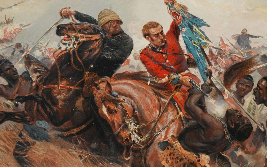
As the horseman turned, the Zulu Host rose as one, scrambled out of the ravine and began a long loping run towards Isandhlwana, which was four miles distant. Within 25 minutes, advance units of the Zulu regiments came streaming over the spur at the edge of the Nqutu plateau towards the British line in numbers that seemed endless. The right horn swung behind the mountain; the chest descended to the plain in front of the most forward positions of the camp; and the left horn ran in a wide arc towards a saddle that connected Isandhlwana with a nearby koppie. The Zulu force stretched in an immense tide across the front line of the defenders and, as the initial volleys crashed out, the fire took a crippling toll of the Zulus.
This was the battle that everybody had wanted – with the Zulu power immolating itself on Imperial volley fire.
Initially it did go well for the British, but a flicker of concern started to pass over some of the officers. Here and there the firing became erratic as some men slipped out of the line in order to requisition more ammunition. As most of the troops had joined battle with 40 to 50 rounds of ammunition, that was soon expended. Drawing fresh ammunition meant a written requisition and opening a heavy wooden ammunition box fastened with two copper bands and nine large screws. The ammunition boxes had not been laid open at the start of the battle and the supply and availability of ammunition to the soldiers of the line was simply insufficient; so the firing began to slacken.
There were two further inadequacies to the British order of battle: instead of the companies being drawn into a tight defensive formation, they were spread out; and units of native auxiliaries were posted at some critical junctures.
The Zulu warriors noted the diminishing rate of fire; and from the Zulu ranks a voice cried out invoking one of Cetshwayo’s many praise names: The Little Branch of Leaves That Extinguished the Fire gave no such order as this! Thousands of Zulus heard him and took fresh heart. The impi that had been relatively quiet stamped their feet and rattled their assegais against their shields, shouting war cries.
To a man, two companies of the Natal Native Contingent fled the field of battle in confusion, leaving a gaping hole in the line of defence. The Zulu regiments poured in and many British troops were taken from behind, unaware that the enemy had breached the perimeter of the camp. From that point on, organised resistance ceased and the result of the battle was all but inevitable. Here and there pockets of soldiers formed themselves into ‘hedgehogs’ and fought until the last. By four o’clock in the afternoon it was all over: the slaughter of the battle and the subsequent pursuit of those fleeing the scene of carnage were complete.
There had been 1 800 men in the camp at Isandhlwana at noon and perhaps 350 survived. The entire baggage train had been either looted or fired; and the work of six months of preparations lay in ruins.
The Zulus departed the camp consumed by raging thirst and a great hunger; they had given battle with a high-hearted courage and fought in their great tradition. The warriors streamed back across the Nqutu plateau and by nightfall, the greatest military force that Africa had ever assembled had dispersed.
Chelmsford, who had been receiving conflicting messages throughout the afternoon, marched into the camp at Isandhlwana during the evening, leading the force he had left with in the morning together with those he had joined, to a scene of utter devastation.
Later that same day the uThlwana and uDloko regiments of the Undi Corps attacked the supply station at Rorke’s Drift. There a single company of some 150 men of the 2nd battalion the 24th Regiment of Foot held at bay an attacking force of 4000 Zulu warriors into the early hours of 23 January, over a period of ten hours. After grievous losses, the Zulus conceded defeat and withdrew. The defenders had been arrayed in serried ranks behind barricades of bags filled with mealies and piled biscuit boxes. Firm and sensible command had carried the day at Rorke’s Drift. Eleven Victoria Cross decorations were awarded to men of the force that had defended Rorke’s Drift.
Following the disaster at Isandhlwana, Natal was seized with panic and was in fear of a Zulu impi descending on the Colony. As it happened, Cetshwayo had given strict instructions to his commanders that they were under no circumstances to cross the southern border of Zululand into Natal. Dabulamanzi, Cetshwayo,Äôs half-brother, who led the attack on Rorke’s Drift had disobeyed the orders of the Zulu monarch.
Lord Chelmsford rode into Pietermaritzburg with his staff on the evening of Sunday 26 January, by which time the town had been turned into a fortified bastion. Chelmsford had a clear conscience; he had left sufficient strength to defend Isandhlwana and the proper tactics to be employed in the event of an attack being mounted on the camp were known to the most junior of officers.
The colony and soldiers of the British Force sought a scapegoat and the onus of blame fell on Durnford, who had been in command at the time of the battle. Frances Colenso (daughter of Bishop Colenso) who had for some time conducted a discreet love affair with Durnford, leapt like a tigress to defend the Durnford name. But it is hard to see that anyone else was ultimately responsible for one of the most notorious failings in the annals of British military history.
Reinforcements were awaited from England and in the interim every town, village, settlement and farmstead in Natal was defended with whatever was available.
The right flank column under the command of Colonel Pearson crossed the lower Tugela on 11 January and advanced as far as Eshowe, having bested Zulu attacks at Inyezane and Gingindhlovu. By the end of February however Pearson and 1 700 other combatants had succeeded only in becoming besieged at Eshowe and would have to wait until 3 April for relief.
The combination of the disaster to the central column at Isandhlwana and the Pearson column becoming bottled-up in Eshowe, meant that the left flank column had no strategic role, although it could harry the enemy. Luckily it had the services of two very capable officers – Lieutenant-Colonel Henry Evelyn Wood VC in overall command; Major Redvers Buller heading up the Frontier Light Horse, a mounted squadron of some 600 volunteers. On 28 March Buller led an attack across five miles of the flat-topped mountain of Hlobane; it was an indecisive encounter that failed to dislodge a force of approximately 2000 Zulu warriors. On 29 March, an impi of 18 000 warriors attacked at Kambula, south-west of Hlobane. Wood had 2 700 men securely entrenched behind laagered wagons and the attack was rebuffed; the Zulus lost over 2 000 men in a withering cross-fire whilst the British dead amounted to precisely 29 men, further proof, if any were needed, that the defeat at Isandhlwana had been brought about by ineffectual command.
Reinforcements arrived from England during April and Chelmsford launched a second invasion of Zululand on 31 May, crossing the Blood River at Koppie Allein, twenty miles to the north of Rorke’s Drift, with a force of some 10 000 troops, 16 field pieces and four Gatling guns. The route to Ulundi, site of the royal kraal, was circuitous and undulating. The column initially trekked fifteen miles north-east to the Tombokola River, a tributary of the White Umfolozi, where a further disaster befell the British adventure in Zululand. The Prince Imperial of France, Napoleon Eugene Louis Jean Joseph Bonaparte, who was serving as an aide-de-camp to Lord Chelmsford, was killed in ambush by a party of Zulus.
The column then turned south-east before picking up the road to Ulundi, south of Ibanongo. The total distance covered was about 80 miles. Chelmsford reached the vicinity of Ulundi at the end of June and gave battle on 4 July. The Zulus attacked a strong British square with 20 000 men, all that remained of the young manhood of the nation. The Zulu regiments came on hesitantly, there was not the ferocity of the previous encounters, and were scythed down by repeated volleys of breech-loaded firearms, four ranks deep.
No Zulu got to within 30 yards of the British line and after half an hour the square was ringed with dead bodies. An hour into the battle and the momentum of the Zulu attack faltered, the impi started to retreat and the 17th Lancers were sent out in pursuit. Thousands more of the House of Shaka died at Ulundi – the Zulu nation had been vanquished. About 8 000 Zulu warriors died in the war and twice that number were wounded. The official British returns, listed 1083 men killed in action.
Chelmsford departed his command in South Africa on 27 July having to all intents and purposes been superseded by General Sir Garnet Wolseley, who had been appointed Governor of Natal and of the Transvaal,m among other responsibilities. Wolseley’s most immediate task was to capture Cetshwayo, who had fled the field of Ulundi following the loss of the battle and destruction of his kraal. The Zulu king was eventually run to ground north of the Black Umfolozi River, some 20 miles from Ulundi, during the last week of August. Cetshwayo was initially held in Cape Town and in 1882 sailed to England with a small entourage. Cetshwayo was immensely popular in London and large crowds gathered outside the house in Kensington where he stayed. He returned to Zululand in 1883 and was restored as the monarch of the Zulu people, but in name only. Cetshwayo had lost half of his kingdom and the remainder had been sub-divided into thirteen kinglets (a classic example of imposing tutelage by means of divide and rule). His power was gone. He died on 8 February 1884.
In 1906, sparked by the imposition of additional taxation, the Bambatha Rebellion symbolised the end of the Zulu nation; it was the last Zulu rising and accounted for 2 300 deaths.
Within 33 years of the ending of the Anglo-Zulu War of 1879, the prevailing political force in present-day South Africa was founded.
During the latter half of the twentieth century there were people who could recall The Battle of Isandhlwana in which the greatest army Africa has ever fielded annihilated an imperial squadron equipped with the most modern military equipment of the day.
The Zulu peoples of South Africa presently number some 11.9 million and constitute 23.8 per cent of the population. At the time when Shaka assumed the paramountcy in 1816, it is believed that their numbers were little more than 5000. Today the President of The Republic of South Africa is a man of Zulu descent, fiercely loyal to the culture and history of his people.
Zululand has changed little since the war of 1879. Dusty roads snake over rolling hills, scarred with dongas and the sites of the battlefields are marked with whitewashed cairns.
There is a stone arch to mark the site of the British square at Ulundi. And on one wall a plaque reads:
IN MEMORY OF THE BRAVE WARRIORS WHO FELL HERE IN 1879 IN DEFENCE OF THE OLD ZULU ORDER. It is the only memorial that has ever been erected to honour the Zulu nation.

by admin | Nov 13, 2011 | 2011, Talks
Speaker: Andrew Duminy
The local legend: According to Pat Storrar, the beacon was erected on the Island in 1772 (the Van Plettenberg website says 1771), inscribed with the latitude and longitude of Plettenberg Bay. The caption on the photograph of the beacon in her book Portrait of Plettenberg Bay states that it was ‘replaced twice’, but she does not provide details of when this took place (according to the Website, it was replaced by Harbour-Master John F Sewell by a stone beacon in 1881).
This is more or less repeated by Clare Storrar in his 1999 edited version of the Sewell diaries: “The navigational beacon was used by mariners to set their chronometers to Greenwich Mean Time for longitudinal and astronomical calculations.
The original beacon was a baulk of stinkwood erected in 1772. It has been replaced/moved several times since then. It was last moved when the second Beacon Island Hotel was built in 1971. Inscribed on this stone beacon is: (Latitude) 34° 3′ 38˝S, (Longitude) 23° 22′ 55˝E. Magnetic declination 7′ 29˝ W.1864.” (Its actual position is 34° 3′ 45″S, 23° 22′ 32″E.)The story of the erection of the beacon has become part of Plettenberg Bay folklore. We are unfortunately not able to ask the Storrars about the source of their information. They were both meticulous researchers. I intend to show, however, that there was no beacon in 1772 and that it must have been placed there much later.
How were latitude and longitude established?
Latitude can be established with a reasonable degree of accuracy by means of erecting a vertical pole on a flat surface. If the length of the shadow is measured at midday – when the shadow is at its shortest – the angle formed by the end of the shadow from the top of the pole can be calculated by trigonometry. This angle is the degree of latitude, once allowance has been made for the northerly and southerly movement of the sun between the solstices. At sea, this measurement was made with a simple instrument known as a cross-staff and, by the 1750s, the invention of the sextant had made these measurements much more accurate. (A sextant makes it possible to view objects simultaneously through paired mirrors, one of which is fixed to a moving plate. When the two objects are lined up, the angle formed can be read off on a scale on the bottom of the instrument by means of an indicator on the moving plate.)
Establishing longitude is much more difficult. Degrees of longitude are measured from a zero meridian. The Dutch usually used Amsterdam or Tenerife. The French used Paris or the Ile de Fer in the Azores. The British used Greenwich and the Greenwich meridian was internationally adopted in 1884 – many years later. Degrees of longitude east or west of this position are calculated by a difference in time. Because the world is a sphere, there are 360 degrees of longitude in a daily rotation; and, as there are 24 hours in a day, each hour translates into 15˚ of longitude.
During the 18th Century, there were three ways of establishing longitude. The first was developed by the famous French astronomer Cassini, who established the French Observatory in Paris in 1669. He discovered, using a powerful telescope, that the moons of the planet Venus have a regular orbit; and was able to time these movements, using two pendulum clocks, the one beating every second and the other every half-second. This made it possible to establish the longitude of other positions on the earth’s surface by means of making these observations from there and comparing them with those recorded in Paris. All that was necessary was the transportation of a powerful telescope and an accurate clock to the other positions. The French Academy of Sciences sent expeditions to a number of places on the earth’s surface to do this, so making it possible to draw more accurate maps of the world and to discover the size and shape of the earth (was it round or was it pear-shaped?).
In 1685 such an expedition called at Cape Town when the Jesuit priest Guy Tachard was the first to attempt to calculate its longitude. This was followed by another French project in 1752, when the astronomer Nicolas Louis Lacaille was sent to the Cape. Using a more powerful telescope and armed with Cassini’s tables, he situated his laboratory in Strand Street and, after making numerous observations, concluded that its position was 16˚8″ east of Paris (or 18°20’22” east of Greenwich; its actual position is 18°27’E). Lacaille was also instructed, once he had established this longitude, to measure a section of the Cape Town meridian in order to assist in the calculation of the size and shape of the earth. He did so by first measuring out a baseline somewhere near Darling and then surveying a chain of triangles between there and Cape Town. His measurement created something of a stir in scientific circles because they did not tally with measurements that had been made in the northern hemisphere – with significant implications for the size and shape of the earth.
The second means of establishing longitude was by means of what were called ‘lunar distances’. This method came about as the result of the refinement of the sextant and after numerous observations and calculations had been made by astronomers in Europe regarding the movement of the moon relative to the stars and planets. In order to establish longitude, three observations had to be made and repeated as often as possible. The first was the height of the moon above the horizon. The second was the altitude of the chosen star and the third was the distance between the star and the moon. These readings then had to be ‘corrected’ for refraction and parallax and were then compared with records that had been compiled at observatories in Europe, published in what soon became known as ‘nautical almanacs’.
The third method was by means of a chronometer, a spring-driven clock which keeps time accurately over long distances and is not affected by changes in heat, gravity, barometric pressure, or movement (most importantly the movement of a ship at sea). A trial version of the H3 took 19 years to develop and was first tried in 1761. It thereafter took many years to perfect, so that it was not until the early 19th century that it came into general usage. The chronometer made the calculation of longitude much simpler because it showed the time at the zero meridian. The establishment of longitude therefore became greatly simplified, because all that was necessary was that the time of day at the other position had to be determined.
Who could have placed the beacon in 1772 (or 1771)?
In 1772 Plettenberg Bay was an extremely remote corner of the world. As Pat Storrar herself goes on the explain, six years later (in 1778) the Dutch ship Katwyk aan Rhyn visited the Bay and the captain recorded that the bay itself was not marked on his charts, let alone the beacon. Strange as it may seem, the Dutch avoided this coastline on the journey to and from the East, keeping well to the south to avoid the treacherous rocks as well as the Agulhas Bank. The most accurate and detailed survey of the coastline had been carried out by the French mariner d’Apres de Mannevillette in 1752. This was a running survey and he established longitudes by means of measuring ‘lunar distances’ with a sextant, a technique he had helped to perfect. He did not land at Plettenberg Bay, so could not have erected the beacon on the island.
There are only four persons who set foot in Plettenberg Bay at this time who might have been interested in establishing its co-ordinates and who may have possessed the expertise to do so. They were:
Carl Peter Thunberg. After studying Medicine and Natural Philosophy, he arrived in Cape Town in April 1772 to collect specimens for Carl Linneaus, the Swedish botanist. During the next few years, he travelled extensively and visited Plettenberg Bay late in 1772, having come on horseback (some of the way on oxback) over the difficult terrain east of what is now George. With two unnamed companions, he was the first to travel from Plett, through what is now Prince Alfred’s Pass to the Langkloof, where he rejoined his baggage van. In March 1775 he proceeded to Java and Japan. As he had passed through Plett only briefly and was on horseback, he would not have been able to transport a bulky and delicate telescope. He also makes no mention of any astronomical observations in his recollections.
Robert Jacob Gordon, who traveled around the Cape Peninsula with Thunberg and Masson in May 1773. According to Gordon’s biographer (Patrick Cullinan, pages 21-2), he then undertook a long journey and it is speculated that he may have been one of the two unnamed companions who accompanied Thunberg on his brief visit to Plettenberg Bay. He was certainly interested in mapping, but, if he did in fact visit Plett with Thunberg during 1773, would not have been here long enough to make accurate observations. It must also be said that he paid a second visit to Plett 14 years later, travelling down what is now the Prince Alfred’s Pass from the Langkloof on horseback. On this occasion, he spent four days exploring and produced the large panoramic painting of the Keurbooms River mouth from the top of the hill. His biographer Patrick Cullinan says Gordon took ‘various bearings of the area’ while staying at Wittedrift (page 57) but there is no mention of his having established longitude. Before his suicide in 1795, he was busy drawing a huge and detailed map of the Cape, now in the Rijksmuseum in Amsterdam. The southern parts of the Cape are blank. This seems to indicate he did not have this information and consequently could not have been responsible for the beacon on the Island.
Van Plettenberg. On his expedition, which visited Plettenberg Bay in November 1778, the Governor was accompanied by the surveyor Leiste, who subsequently drew a map showing the route that had been followed. While here, van Plettenberg erected the VOC beacon proclaiming Dutch ownership. Leiste’s map contains very little accurate information and places Plettenberg Bay (and Beacon Island) at latitude 4.5˚ east of Cape Town (22˚32′ east of Greenwich, an inaccuracy of nearly a minute). These positions were probably obtained from Mannevillette’s 1752 chart or from a later chart produced by the Dutch East India Company.
Le Vaillant spent about 6 months in this area in 1782, collecting birds and shooting anything that moved, including nearly 30 red hartebeest and an elephant. Although he compiled a map after his return to France, that contains many inaccuracies, indicating that he was not interested in recording latitudes accurately, let along longitudes.
None of these individuals had the skill or the necessary equipment to calculate longitude.
One other possibility is Francois Renier Duminy, a French mariner who had learnt the latest techniques of navigation during his service in the French East India Company (possibly from Mannevillette himself). He carried out a new survey of the southern Cape coast between 1781 and 1787. This had become necessary because Mannevillette, for reasons best known to himself, had produced a revised and completely inaccurate version of his 1752 chart in 1775. During this survey, Duminy did a detailed survey of Plettenberg Bay in 1786. It shows the Robberg, Beacon island, the Lookout rocks, and the coast stretching as far as the Storms River mouth. Using a sextant, he calculated the latitude of Plettenberg Bay as 30° 50’S and the longitude as 5°15′ east of Cape Town (23°42’east of Greenwich).
As Duminy was the first to make these calculations of latitude and longitude, he was the only one of the early visitors who would have been able to inscribe these details on a beacon. There are two reasons, however, why I do not think he did so. The first is that he did not show a beacon on his detailed chart of the bay. The second is that his co-ordinates do not coincide with those that were inscribed on the beacon. The latitude on the beacon is given as 34°3’38″S and longitude is given as 23°22’55”, the most significant discrepancy between these and Duminy’s being a difference about 3 degrees of latitude.
My conclusion therefore is that there was nobody during the years 1752 and about 1790 who could have erected the beacon on the Island.
Beacon not shown on early maps
In further support of my argument, it can be shown that a beacon does not appear on any early map of Plettenberg Bay drawn after it was supposed to have been erected. If it was there and, if it was of such importance that navigators used it to ‘set their chronometers to Greenwich Mean Time and to make longitudinal and astronomical calculations’, it surely would have been shown.
I have already mentioned that it does not appear on Leiste’s map, on Mannevillette’s chart or on Duminy’s charts. The first reliable map of the area was drawn in about 1789 after a survey of the region by Johan Friderici and Josephus Jones. This was not a geodetic survey, based upon the establishment of the latitude and longitude, but was carried out using a ‘plane table’. At that time, map-drawing began with the shape of the coastline, obtained from a running survey such as those of Mannevillette in 1752 and Duminy between 1781 and 1787. Inland details were filled in after different landmarks had been observed from various points of observation. Positions were calculated by means of estimating the distance and the direction that had been traveled. Longitude, were therefore entirely a matter of guesswork. These early surveyors would therefore have been very interested indeed in a beacon which showed the longitude of Plettenberg Bay and they would surely have indicated this on their map if it was there. Friderici’s map, however, shows Beacon Island as a bare outcrop with nothing on it but stones and coastal scrub.
The next map to be drawn of the coast was by Lieutenant McPherson Rice in 1795. He had completed a new running survey that year after the British occupation. Like Duminy, he produced a detailed chart of Plettenberg Bay. He would also have had the opportunity to set foot on Beacon Island to erect a beacon there. I think it unlikely however, for the same reason as I have rejected the possibility that Duminy did so. This is that McPherson Rice did not show a beacon on his chart. His estimates of latitude and longitude also do not tally with those inscribed on the beacon: he estimated the latitude to be 34° 6’ 36” S (a variance of 2 minutes from that marked on the beacon) and longitude 23° 48’ E (a difference of 26 minutes) His magnetic variance was 27’ 12” (a difference of nearly 20 minutes).
The most accurate survey of the Cape coast was that of Captain William Owen in 1822, as part of the Great African survey undertaken by the British Admiralty. The main purpose was to survey the virtually unknown coastline of Africa from the Keiskamma River to Cape Guardarfui (the headland of the Horn of Africa in Somalia) but Owen surveyed the southern Cape as well. This was one of the most ambitious survey projects yet undertaken and Owen used no less than nine chronometers to provide him with accurate Greenwich Mean Time. He did not, however, land anywhere along the coast and so would not have been able to place the beacon on the island or to read the inscription on a beacon, if it was already there. His chart shows the longitude of Plettenberg Bay at about 23˚E.
The absence of any record of a beacon on any of these early maps and charts supports my contention that the beacon did not exist and was not ‘used by ships at sea to set their chronometers for longitudinal or astronomical calculations’.
Alternatives
As there is today a beacon on the island and as it could not have been placed there before 1772, we must assume that the beacon was placed there at a later date. The first reference I can find to a beacon is in Sewell’s diaries. (He was Harbour-Master of Plettenberg Bay between 1874 and 1897.) On May 12 1893 he refers to a notice calling for tenders to enclose ‘the beacons on the island and van Plettenberg’s. (I don’t think he was referring to more than one beacon on the island, but was using the plural ungrammatically). On 10 January 1894, he then refers to the fact that a wall had been built around it (Storrar, pages 185, 193). The beacon was therefore definitely there in 1893 and it must have been there for some time if Sewell was worried about its deteriorating condition.
The first surveys. Before we go on to discuss further the question as to who placed the beacon there, I have to digress and tell you about another chapter in the history of mapping in South Africa. This is land-surveying. The drawing of accurate maps depends upon the establishment of the geodetic co-ordinates of as many positions as possible by means of a chain of triangles. It begins with the measurement of a baseline, measured from a position the co-ordinates of which have been established by means of astronomical observations (this is known as the ‘datum’). Once this has been done, the position of other landmarks can be established by means of triangulation (trigonometry). The instrument used to measure these angles was called a theodolite. Those used in the first great surveys undertaken in the nineteenth century were huge and heavy (that used in the great survey of India led by Sir George Everest, for example, weighed over 500 kilograms). They had to be transported from one position to another, up and down hills, across rivers and to the mountain summits. Survey work was therefore extremely laborious and time-consuming. The Great India survey, led by Sir George Everest, took 64 years to complete.
The first survey undertaken in South Africa was that of Lacaille. The next survey was that of Charles Michell, who became Cape Surveyor-General in 1828. He started his survey in 1834 in the Tsitsikamma region. When I read this, I for a moment imagined that our problem had been solved, but his biographer (Gordon Richings) informs us that Michell commenced his survey in the Langkloof and visited Plettenberg Bay only briefly on 16 November on his way from Great Brak to Avontuur (page 76). Michell abandoned his survey shortly after he had begun this work because he had to proceed to the Eastern frontier, where war broke out at the end of the year. He visited Plett again in 1836, when his records show that he ‘took bearings’ of Driefontein, Tsitsikamma, the mouth of Witte Els River, Plettenberg Bay Point (the Robberg) and Formosa Peak (page 100). There is no mention of Beacon Island.
Because of the discrepancies between Lacaille’s measurements and those obtained in surveys in other parts of the world, the Cape Astronomer Sir Thomas Maclear was instructed in 1839 to repeat Lacaille’s survey of the arc of the Cape Town meridian. As no trace of Lacaille’s positions could be found, he measured a new baseline and, between 1841 and 1846, surveyed 31 triangles, extending as far south as Cape Agulhas. This, for the first time, established a number of positions to which other surveys could be linked. (Maclear marked his positions with stone cairns 14 feet high so that they would not disappear as Lacaille’s had done.)
Captain William Bailey. That brings me to the last possibility and to the conclusion of my talk. Between 1859 and 1862 a major survey of the southern Cape was carried out by Captain William Bailey on behalf of the British Admiralty. The reason for this was that in 1852 the tragic loss of the Birkenhead had occurred at Danger Point, near Hermanus. The reason for this loss was the complete unreliability of the existing charts. The aim of the survey was therefore to establish the precise geodetic positions of recognisable landmarks along the coastline.
Between 1859 and 1862 Bailey surveyed a chain of triangles stretching from Cape Agulhas to Port Elizabeth, erecting beacons (some of stone and some just a wooden stake in the ground, like that on the Beacon Island). Most of his data, together with his two large theodolites, were lost when the ship that was taking them back to Cape Town was wrecked near Cape Agulhas. Fortunately, Bailey had kept his notes and many of his readings and, from them was able to produce a report which showed his triangles, extending eastwards as far as a position near Grahamstown in the Eastern Cape. Fifty years later, the beacons he had erected could not be found when Henry Fourcade did his surveys of the mountains. That is another story.
My conclusion is that the beacon on the island was placed there by Bailey during this survey. If this is so, it was one of the few remnants of this ill-fated episode in the history of South African mapping. His equipment and his records were lost in the wreck of the Waldenstein, but the beacon survived where it had been placed, thanks largely it seems to Captain Sewell’s interest. It is a great pity that the original, like so many other historical relics of Plettenberg Bay, has been lost. I hope, however, that I have succeeded in uncovering the truth surrounding its history.

by admin | Nov 3, 2011 | 2011, Talks
Speaker: Peter Duminy
This Talk has been substantially motivated by recollections, especially remembrance of straws in the wind that preceded – and help to account for – the formation of our Society 30 years ago. I have called them ‘Defining Moments’.
Why? Because, the more one thinks about it, the clearer it becomes that founding of the Plett Historical Society in November 1980 was attributable to several happenings, and to a number of rather special people combining to make it bound to happen – if not necessarily in 1980, then certainly later, or perhaps even sooner.
I expect we can, most of us, remember more or less when we, individually, first became interested in Plett’s absorbing history, not least the lives and local achievements of some of its famous personalities.
For me (and possibly for many others) Winifred Tapson’s TIMBER AND TIDES the story of Knysna and Plettenberg Bay, first published in 1961, illuminated much not previously known about Plett and Knysna. I also learned from it that my great-great-great-grandfather had been in command of the ship De Meermin, on to which Plett’s first hewn timber was loaded and carried away in August 1788.
Certainly Tapson’s book was NOT the first time that Plett, its historical and other attractions had been described in print. But for me, certainly, Tapson’s printed words – and more particularly the interest in past events that these words began to stir – were undoubtedly among this Society’s ‘Defining Moments’. And this claim is tabled for your consideration, even though it would then to be another 20 years –or very nearly– before the Van Plettenberg Historical Society would be founded.
Meanwhile, perhaps entirely unrelated to Tapson, there were other events and people combining to make our Society a virtual inevitability.
For one thing, the 1960s also brought serious Archaeological enquiry (and indeed activity) to Robberg, for the first time. This is, of course, a reference to what we now prize as the Nelson Bay Cave, the remarkable site that provides compelling evidence of communal living going back many thousands of years.
In sum it was by the late 1960s becoming perfectly clear that Plett, apart from its other attractions, in one way or another also offered much that was of compelling historical interest.
Unrelated and in its own way no less a Defining Moment (or Straw in the Wind), was the Storrar phenomenon – more correctly the ‘Storrarphenomena’, because there were two of them, Pat and Clare, widow and widower, both remarkable people, who had been wed in Johannesburg in 1959 and had come to Plett as permanent residents in 1971.
There were now nine years to go before the Historical Society would be founded; and almost as long as that, if memory serves, before it would come to be widely discussed.
Let’s tick off, in chronological order, some of the things that proceeded to happen in those nine years:
Both Storrars were amazingly industrious and productive until very late in their long lives. Halfway through the Seventies Pat Storrar had already researched the life and antecedents of George Rex. Indeed, she had already published the results (in 1974). I’m sure we all of us remember George Rex of Knysna as the book, more than any other, that gave Pat Storrar an international reputation.
After that tour de force Pat Storrar was soon hard at work again – on unrelated, but nonetheless always local subjects.
And at this point let’s dip briefly into the Duminy family archive. The script is undated, but we have a letter, dated 29 November 1976, which JP (Dad) received from a cousin – one thanking him for supplying a copy of ‘the talk which he [Dad] had recently “…. given at Plettenberg Bay.”
That informal talk had in fact been about the life and especially the 18th Century Plettenberg Bay connections of Francois Renier Duminy. It had been given at the invitation of Pat Storrar.
In the present context, the full significance of this date – 1976 – anticipating the coming of the Historical Society by fully four years, could conceivably have lain in a number of factors. The talk was certainly a means of garnering information for a particular purpose – another book in the making. Perhaps, and with the benefit of hindsight, it could also have been a sure sign that thoughts of establishing the Historical Society were taking shape in certain Plettenberg Bay minds.
Yes indeed, Portrait of Plettenberg Bay was on the way. As we know, this, the next Storrar book, was a remarkable, well researched and, in sum, an amazingly detailed account of our local history. Another Storrar masterpiece, it was to see the light of day in 1978.
Quite soon after that, and out of the blue, came the uncovering of the Sao Gonzales relics in the shape of fragments of Ming and other porcelain. These remarkable finds on Johan Jerling’s building site in the hoek of Robberg came in November 1979 (though they would not be made public until June 1980). The widespread excitement about that announcement, locally and much further a-field, has been well chronicled.
Whichever way we look at these developments, there can be no mistaking the quality of ‘defining moments’. In retrospect and taken together, they surely suggest to us that there were elements of growing inevitability about what was to follow in November 1980: formation of the Plett Historical Society.
Johan and Ingrid Jerling would be among our foundation members, and that is one reason why it is good to see them here today. Another reason is that, as I’m sure many of us know, Johan’s great-great-great-grandfather (the Jerling stamvader) was directly involved in the building of the Timbershed some 225 years ago. His was in fact the successful tender.
We may take it that he and my great-great-great-grandfather were rather more than mere nodding acquaintances.
To give you a little serious history: In January 1786 the Politieke Raad (the powers-that-be) in Cape Town instructed Landdros Woeke of Graaff-Reinet to follow up previous favourable impressions about the availability (and transportability) of Plett area timber – those gained by Governor van Plettenberg (in 1778) and Francois Le Vaillant in 1782.
Now there was to be speedy action: Woeke went to Plett without delay. So too, my great-great-great grandfather, in his case with a mandate to report on shipping requirements, including vessels and seasons best suited for timber shipments. The perceived need was great, so much so that the Politieke Raad issued further instructions on 4 August 1786, among these that a magasyn (storage shed) was to be built without delay, the tender for this to be awarded to the most competitive bidder. That would be Jacob Jerling.
If I may now jump forward by some 225 years, Johan Jerling has for some time been making every effort torestore the Timbershed – something that is now much needed, having last been done (with his support and that of a good many of our then members) in the 1980s hence during the first five years of our Society’s existence.
Johan Jerling has in recent days passed on some promising news: an ad-hoc committee chaired by architect Paul Scheepers (who was intimately involved in the last restoration) has recently had constructive meetings with the Municipality’s heritage committee – so useful, in fact, that promising recommendations will go before our Town Council next week. Then, if all goes well, the plans will be forwarded to the National Heritage Council for approval, to be followed by action. So do please ‘watch this space’, as they say.
But that is jumping ahead. Let’s havesome reminders of precisely what the founders had in mind for us in 1980. This is all laid out in seven succinct clauses of our Constitution. All are worth mentioning, providing, as they do, permanent guidelines (or call them ‘yardsticks’) against which to assess three decades of past performance – excellent, good in spots, or what you will.
Among the Society’s stated objectives (I won’t repeat them all) were and are:
- To collect and collate information about Plett and the district;
- To collect and preserve documents [of all kinds] ;
- Preservation and eventual exhibition of
- objects in any way related to Plett and district …
- Preservation of buildings of historical interest.
- Dissemination of results through the medium of a Bulletin or by other means
- To place descriptive plaques on places of interest.
- To encourage the establishment of a local museum.
Measured against these and perhaps other objectives, we surely have not done badly; and owe a great deal firstly to our founders for their vision and for the dedication that successfully carried us through the early years. Likewise to their successors in continuity, combined with equally conscientious service on the part of those following in the founders’ footsteps. It is sometimes invidious to name names. But some do tend to leap out at us today.
Consider this: at the end of the first year (when our membership list had already topped 200), we find surnames that have been continuously associated with the management and direction of our activities, up to this very day.
Three surnames in particular pop out – McNally, McCarthy, Vickerman: those of one President and two past Chairmen. We celebrate the fact that John and Molly McNally are still with us. And that the two past-Chairmen were succeeded in other active and ongoing capacities by their surviving spouses – Sheila and Lovell.
All six of these stalwarts were Foundation Members. About 25 of our First Year supporters are still on the membership list.
Foundation members who are with us today– and we don’t claim to have captured all the names – include Clive and Colleen Noble, Margaret Parkes, some Duminys …… And we all know that, but for the vagaries of time, this list would be much longer.
The Storrar name will always feature on our informal Honours List.
I don’t have to mention that Pat wrote more books: covering the San Gonzales disaster and all that followed 350 years ago; about Thomas Bain the road builder extraordinaire; and the story of Belvidere (to name but three).
Clare Storrar was a single-minded researcher, too; and a competent writer: to him we owe the published Sewell diaries and an important book about the ‘Tzitsikamma genius’ Henry Georges Fourcade…
What our founders certainly could NOT have imagined way back in 1980 was that the Internet would someday make it so much easier to meet some of our objectives. We may nonetheless be forgiven for thinking they were truly inspired; and that the Society’s Constitution has all along cried out for both the Internet and a Website!
And now – with this huge social and technological benefit within our grasp – that pletthistory.org will constantly challenge our capacity to achieve substantial inclusion of the historical nuggets that we have, in the course of 30 years, accumulated in print and will continue to amass.
Making that wealth of information more readily available – not only to Members but also far and wide, across Planet Earth – is exactly what we are now addressing with the setting up of our Website. We would, of course still be a long way from maximising the opportunities (by all means call them our responsibilities) in this respect.
Having access to the titles of 175 Talks and those who have given them, as will initially be available, is far from equating with access to the Talks themselves. That is a longer-term objective, to be achieved in response to demand. But I am confident that we are going to make steady progress in the matter of making all our valuable information, including photographic material, widely accessible on the website we have named pletthistory.org and which we, the van Plettenberg Historical Society, will soon be commissioning .
by admin | Sep 11, 2011 | 2011, Talks
Speaker: Clive Noble
The Read Family
James Read came to South Africa in 1808. He was a shipwright. He lived and worked in Cape Town. He went to George in 1823 where he married Anna Terblanche. They had 3 children. The 2 sons, Ignatius and James, in 1862 bought the farm Matjesfontein on the east side of the Keurbooms river from the Jerling family. They later owned the whole of the Keurbooms area.
Later they extended their property interests to the Crags. Lourens Read owned what is now called Loredo.
The farm house which is on Woodlands farm, now called Kurland was built by the Read’s in 1886.
William Newdigate
He was the third son of Francis Newdigate and was keen to become a farmer. He set sail for South Africa in 1845 at the age of 21. He was given a capital of 3000 pounds and income of 100 pounds a year. He persuaded a number of English farmers and skilled artisans to help him.
The English Settlers 1850
John Cowley
William Derbyshire
George Shaw
Giles Shaw
William Smith
Charles Smith
William Page
James Thompson
Richard Willard
John Hulme
Elijah Cope
George Tyrrell
William Hewitt
Joseph Taylor
Thomas Preston
The English Settlers 1850’s
William Starbuck
Thomas Noble
John Noble
William Hills
Robert Cowley
Aaron Toplis
Henry Wyatt
Richard Bashford
Thomas Brown
Richard Geist
Richard Conway
Lindsay Best
William Derbyshire
He and his wife Mary and 3 children George, Joseph and Selina disembarked in Mossel Bay. They then travelled by ox wagon to Plettenberg Bay with an enforced stop in George. He built his own house at Ladywood overlooking the Piesang River Valley. He also bought land at Gansvlei which he subdivided for his 3 eldest children George, Joseph and Selina. Mary Anne and William were born when the family lived at Ladywood. Emma, the youngest daughter and her husband Frank Allahn, were set up with a store in The Crags. He earned 76 pound and 8 shillings a year. He was a farmer and millwright. He was the most senior of William Newdigate’s men
REDFORD
Redford Farm was a grant to William Derbyshire in the early 1850’s. It was 895 morgen in size. It was granted also to W.Smith, W.Hewitt, T.Preston and G. Shaw. On it William built a house and a watermill. The house later burnt down in the 1950’s. The watermill stopped working at about the same time. It became home for the Derbyshire’s for many generations. Apparently the original house and our house were similar in architecture. There was also an old barn on the farm. It is uncertain when it was built but it is still there.
Redford House
It was built about 120 years ago. It was built for William and Mary’s granddaughter Amy Bern who married Samuel Cornelius van Rooyen. Her parents were Mary Anne Derbyshire and James Bern. A quarter of the whole farm was inherited by Mary Anne Derbyshire in 1894. Her husband James Bern also bought a quarter in 1891 and in 1904 another quarter in 1912
Amy Bern was left 19/48 of Redford. This most likely was the portion on which we are now. This was in 1926.
Billy Bern, her brother, inherited 19/48 as well. This portion was transferred to Samuel van Rooyen in 1937.
It was sold to Ena Behr in 1940 after which it was subdivided and sold off to others. Our portion was sold to Baren Dina McDonald in 1966.
In 1973 it was sold to Jan Willem Lotz.
Amy Bern lived on Redford all her life. She lived in our house until she was too old to climb the steep stairs.
The local coloureds called it the ‘upstairs house’. She built a single story house next door where she died. This house now belongs to Dr. Goedhals. He is a cattle farmer.
It was owned by the Behr’s for 26 years. They rented it out to tenants, many of whom worked for the Behr’s.
One of these tenants ran a shop from the Barn. We called it the barn because when we first saw it, it was the home to Portia the cow!
In 1976 Redford house was sold to John Ives. We bought it in 1980 in a sorry state.
The Noble family had never lived in The Crags. They left the Newdigates and went to Knysna.
Forest Hall
William Newdigate came to the conclusion that there was no future in farming in the Piesang river valley. He had bought land at the Crags in 1859.
This was 2390 hectares and cost 895 pounds. He had inherited money from his father’s estate on which to build his manor house ‘Forest Hall’. He was asked why he was going so far from civilisation to which he replied ‘I am taking civilisation with me’
Georgina Lister
Daughter of Thomas Bain. A difficult journey to Forest Hall, only 12 miles – ox wagon along the coast
– At Keurbooms river the wagon was floated to an island and then to the other side on empty casks. The horses had to swim.
-Up Slate hill was difficult.
-took the whole day
At Forest Hall
-Formal Dress for Dinner.
-Procession into the dining room, arm in arm.
-Silver candelabras
– China crockery
William Newdigate
He married Caroline Duthie from Knysna in 1851.
They had 9 children, 6 of them were born
at Redbourne and 3 girls at Forest Hall
Frank 1852 Surveyor married Kate Barrington
Caroline 1853 Naturalist Unmarried
Constance 1856 Henry Home Capetown
Annie 1859 married Thomas Hopwood Beacon Island
William 1860 Surveyor Jean Grimmer Kimberley
Arthur 1863 Not a mental giant Longridge
Mabel 1865
Eleanor 1866 Stayed At Forest Hall Longridge
Frances 1867 Typiste In Knysna
The Newdigate Girls
They saved money from the sale of the Silver Spotted Ghost Moth [Leto Venus] to museums in England. With this money they built a school-chapel on the site of the present stone church ‘St. Michael’s and All Angels’ next to the Kurland township which was built in 1905.
The Parkes Lease .
When William Newdigate died in 1884 to raise money to pay out the non-resident family, they raised a bond for 5500 pounds. Parkes had the right to take the timber and pay a % to the Newdigates. No time limit was set, so when all the money was paid back they continued to harvest the timber, despite expensive court cases.
It was left with caretakers but gradually deteriorated. It was leased by a Dr. Sym in 1946 who agreed to repair the place. Again another legal rangle and more money was lost. The house was abandoned. When we first saw it in 1964 there were cows in the house.
Then along came Hillary Peter, a knight in shining amour, who set about the restoration. It was later used as a guest house and subsequently sold to Marius van Biljon, who died in a tractor accident. It was then sold to Michael Johnson who did further restoration. It was finally sold to an Italian Trust who are doing a good job in preservation.
Thomas Bain
Born in Graaf Reinet in1830
He never lived in The Crags but visited Forest Hall.
His great-granddaughter Lucinda Edwards
lives in The Crags
The Nobles
The Nobles worked for William Newdigate for about 10 years.
They then left and went to Knysna.
John Noble’s wife Anne died within a few years of arriving in Plettenberg Bay. She is buried in the grounds of St. Andrews Church.
My side of the Noble family lived in Knysna until the discovery of diamonds in Kimberley. From there my grandfather went to fight in the Boer War and later in the 1st World War. He died in Sabie chasing gold.
My father and I returned to Plett. [The Crags] in the 1980’s. He lived at Loredo and we at Redford.
by admin | Jul 10, 2011 | Talks
Speaker: Dr Taffy Shearing
Today I have been asked to talk about aspects of the South African War from the Cape Colony perspective. And I have decided to stick to ‘Cape Rebels 1899-1902’; and to introduce you all to The Rebel Record, which David and I have just published in three volumes. By definition a Cape Rebel was a Cape colonist who joined the Transvaal and Orange Free State forces and fought against British field forces; and whose rebellion sadly almost led to civil war in the Cape Colony.
When the Boer forces invaded the Cape Colony north of the Orange River – notably leading to the sieges of Mafeking (now Mafikeng) and Kimberley – they either recruited or more forcibly commandeered Afrikaners to fight on their side.
H J de Koker. The very first rebel I dated from Mafeking was David Hermanus de Koker, 55. When the Boer forces were gathering to invade Griqualand West and to lay siege to Mafeking, he boasted he would join the Boers in the Transvaal and return as a Commandant. He did in fact return as a Veld Cornet, with a mauser, two bandoleers and an ammunition waistcoat. He forcibly recruited Colonists, rounded up cattle and wrecked long stretches of the railway line. De Koker fled to the Transvaal prior to the relief of Mafikeng. There he gave a false Transvaal address when captured, so went to Ceylon as a Transvaal prisoner-of-war (PoW 17095). When he returned there was warrant out for his arrest; and that is all I know.
The Cape Colony north of the Orange had been devastated by the Rinderpest – Mafeking had lost 96 percent of its cattle – and many of those who joined the Boers had said they had heavy mortgages, so having made it a condition that the Transvaal would agree to cancel these debts. The Boers said okay, ‘but first drive the Englishman into the sea!
David de Wet. South of the Orange River the Free Staters soon invaded the Stormberg region, from Lady Grey and right through to Colesberg. The well known David de Wet of Buffelsvlei, who owned the Aliwal North Hot Springs and had previously been the Member for Aliwal North in the House of Assembly, joined the rebellion in his former constituency, acted as a guide, attended meetings and urged people to join the Free Staters.
Piet de Villiers. An unknown number of rebels fought with the Boers in the battles along the Modder River – Piet de Villiers of Egmont Herbert with such distinction at the battle of Belmont that General de la Rey promoted him to a fighting general.
The Long Tom gun that had shelled Kimberley fired its last shell on 15 February 1900, the day on which the siege was relieved by General French. In the chaos the Boers could not find oxen to pull the gun and the Warrenton rebels spanned themselves into the traces to do just that until a team of oxen was found.
Bart van Aswegen of Barkly West was later praised as a ‘stout-hearted rebel’ when he held the rebel laager at Dronfield and fought off the guns from three British Army batteries. He kept up such rapid fire that French ordered his men to pull back. The rebels had to abandon the gun, but slipped away in a dust storm.
After the Boer victory at Stormberg the burghers and the rebels quarreled over the spoils. The former took the captured Lee Metford, leaving the Martini-Henrys (which kicked) to the rebels.
Die groot vlug. At the end of February 1900 the situation changed when General Piet Cronje was defeated at Paardeberg. The result of this stunning defeat was that the Boer forces in Natal and the Cape Colony soon turned for home – heading back to the Free State and the Transvaal. The date on which they left, 8 March, became known as die groot vlug, now a firmly forgotten event in Afrikaner history. Olivier had left the defence of Dordrecht, Barkly East and Lady Grey to the rebels who were still holding Labuschagnes Nek outside Dordrecht when the Boer leader crossed the Aliwal North Bridge. The Free Staters had built drifts through the Orange River and had driven huge herds of commandeered sheep and cattle into the Free State.
Gustav van Aardt, Jotham Joubert, Ignatius van der Walt. Some rebels and Boers gave up the war and entered Mozambique, among them Comdt Gustav van Aardt, who had been the rebel commandant of Aliwal North. They were treated sympathetically by the Portuguese. In mid-1900 about 50 rebels from the Cape and Natal arrived as refugees in Amsterdam – these including Jotham Joubert (MLA for Albert) and Ignatius van der Walt (MLA for Colesberg).
Octavius Vermooten. While some rebels followed the Boers over the border, the remainder laid down arms. More than 5000 Cape rebels had been left high and dry – a tricky situation for the British in the middle of a war. David de Wet, who, like many older rebels had not been on commando, was sent by the British to live at Beaufort West under house arrest; with numerous others scattered in villages throughout the Cape.
A leading rebel of Dordrecht – Octavius Vermooten, a lawyer – found himself arrested when he went to Queenstown under the false impression that professional representation of a client gave him immunity from prosecution. He was sentenced to four years in Tokai Gaol and released only in November 1902.
Johannes de Wet. Lord Roberts, General Officer Commanding, divided these surrendered rebels into Class 1 – leaders – and Class 2 – followers or rank and file. As they were Cape Colonists, the Cape Parliament had to deal with the situation and it was October 1900 before the Special Tribunals Act was passed. The leaders were fined and gaoled. Johannes be Wet of Moshesh Ford, Barkly East, fought against Brabants Horse; was seriously wounded in a skirmish near Jamestown in December 1899; was sentenced to three years imprisonment and fined ₤1000; served time at Tokai jail; and was a Convicted Class 1 rebel.
The Class 2 rebels were only sentenced to be disenfranchised for five years – meaning they would not be able to vote whatever their age. The measure was a mild one. And as there were high hopes the war would be over in a matter of months – by Christmas – the Special Tribunals Act was set to run for six months until April 1901.
But the war wasn’t over by Christmas. In December 1900 President Steyn of the Orange Free State sent fresh mounted commandoes under General Hertzog, Commandant Pieter Kritzinger and Captains Willem Fouché, Gideon Scheepers and Johannes Smith racing to the Cape Colony to recruit and to commandeer horses and clothing. Colonists sent their sons to join the commandos – for weren’t they under the protection of Parliament? One youngster went off having been told by his Pa: ‘as daar bloed is, moet daar nie trane wees nie’ and ‘ as hulle jou in a wa huistoe bring moet die koël van voor en nie agter wees nie’.
Most of these rebels joined near the Boer Republics – for instance from the Burghersdorp district there were 1048 rebels, and from Aliwal North and Lady Grey 1268. Nearer to this part of the colony, George produced 11 rebels, Knysna 8, Mossel Bay 3, Willowmore 64 and Uniondale 66.
Coupled with the De Wet invasion, the Cape Colony was in so much of an uproar by April 1901 that the military took over when the Special Tribunals were suspended. Martial Law was again enforced and rebels under arms were facing death sentences for High Treason. The Military Courts tried 800 cases. Few, just a year earlier would have thought that 44 Cape Colonists, as well as some Republicans and Aliens, would be hanged or shot, while 409 of the younger rebels were shipped to St Helena and Bermuda to face sentences of penal servitude for life.
Johannes Petrus Coetzee of Paardekraal, Cradock, 21 years old, was the first to be executed. He was tried in Dordrecht on 26 June 1901 and was hanged in Cradock on 13 September 1901 having been found guilty of High Treason under arms and attempted murder. His body was later reburied in the Cradock cemetery. There was a strong protest by Earl Grey in the British Parliament about the public manner of his death.
The war sadly dragged on and it was May 1902 before the Treaty of Vereeniging was signed between the British and the Boer republics. The rebels could not attend the Peace Talks, as they were not legitimate belligerents. Later the surrender of 3442 rebels was accepted under Proclamation 100 of 1902. Between 700 and 800 did not lay down arms, but fled over the borders. The prisoners of war from Bermuda and St Helena returned in early-1903; then all the rebels were given partial amnesty in March 1903 and sent home. It was 1905 before a General Amnesty for the Cape rebels was declared and they became eligible to vote again.
Boy de Bruin. I heard about Boy de Bruin of Abrahamskraal, Victoria West, some 50 years ago. Boy was 16 when he stole a neighbour’s horse and went off to join the commandos. He simply vanished and was never heard of again. His younger brother, Hugo, who told us the story, was then in his late sixties, and said his parents thought Boy had been drowned in the Orange River – but that it was really only a guess and nobody actually knew his fate. Over the years I learnt just how foolish it was to go looking for a Boer commando alone: there were deserters on both sides who were desperate for a fresh horse.
To start with I collected the names of rebels in a shoebox, but when I did an MA on guerilla warfare through Natal University, in the 1980s, I discovered lists of rebels for every town that had had to be sent in by the colonial magistrates to the Attorney General. In due course these went on to my first Apple computer; and eventually the collection became a database for my PhD on The Cape Rebels of the South African War 1899-1902 at Stellenbosch University in 2005. But without my husband David’s devoted help and expertise we would never have documented 15 433 Cape Rebels covering 984 pages in three volumes. Next year marks our Golden Wedding , so we decided it was time to stop. A 50-year project is enough.
Many aNel/Nell, Kruger, Botha, Jacobs, Marais, van der Merwe, Coetsee/Coetzee. Our greatest problem in documenting this section of South African history was that there are comparatively few surnames among Afrikaners. It became a huge task to sort out the 304 Nells/Nels. The same applied to the 297 Krugers, 184 Bothas, 163 Jacobs, 164 Marais rebels , 288 van der Merwes and the 342 Coetsees/Coetzees – to give only a few examples. Because of this we have included voter numbers, ward numbers and physical descriptions where we have found them.
We were puzzled that comparatively few rebels became PoWs – until I found a leather-bound volume in the Cape Archives (AG3558), which gave the rebel’s name and correct colonial address, as well as a false address in the Transvaal or the OFS which the rebel gave when he was captured. In this way he had hoped to avoid the heavy sentences meted out to rebels who were harshly treated under Martial Law. Frequently it appears that letters from home gave the game away.
Some examples:
Hendrik Bernadus C Aucamp, 23, Knapdaar, Albert, captured at Zuurfontein on 15th March 1900, giving the false address of Vlakplaas, Bethulie, in the Boschiesspruit cornetcy. PoW 5018. To St Helena with OFS PoWs. Warrant of arrest issued on his return to the Cape Colony, 17 July 1902.
Johannes Hendrik Barnard, 63, Bellock. Barkly East, captured at Klipplaat on 7th February 1901, where he gave the false address of Klipkop, Rouxville, in the Groot Rivier cornetcy. PoW 18395. To Bermuda, returning on 18 September 1902.
Johannes Adriaan Bester, 59, Pniel, Barkly West, captured at Hoopstad on 7th May 1900, where he gave the false address of Niekerk’s Kuil, Hoopstad , but was unable to name the veldcornetcy. PoW 7158. Sent to Simonstown.
When we farmed at Fraserburg I used to ask the local people about the rebels and then discovered that there were two South African wars. One went by the name of the Boer War, in which Kruger was sone dirt and the Brits wanted the gold mines. But other people talked of the Transvaal War and said it had taken place because the Transvalers had made trouble for everybody – and that they had invaded a perfectly contented Cape Colony and ruined it out of revenge. Either way, I heard, nobody knew which was worst. If you saw a cloud of dust coming down the road, it was either the Khakis or the Transvalers; they were hungry; and their horses ate up the farmers’ lucerne.
One and all said it was easy to become a rebel, but to stay alive, find food, and to have the Khakis after you month by month was bitter. And when the rebels returned they all said they were just thankful to have made it home in one piece.
Izak Vorster. Mr Crouse of Richmond told me about his grandfather Izak Vorster, a Colesberg Rebel. In the Murraysburg district in 1902 they were forced to eat dogs, they were so hungry. They starved them, cut them up, cooked them and slept well; but forever after there were times when he would hear the dogs barking and feel them jumping up on his legs.
Ockie van Schalkwyk told me that after some months he, too, wanted to join the rebels. Next thing, a couple of uncles on commando rode up, gave him the biggest hiding he had ever had and telling him not to rebel. His older cousin, who had watched it all sitting on his horse, rode over saying: Ockie kan jy dan nie sien nie dat die pad voor eindeloos is? (Can’t you see the road ahead is endless?) And rode away.
Karl Steyn and sons. I became interested in certain families, especially the Steyns of Kaalplaas, Cradock. Karl Steyn and his sons Willem and Hendrik were all imprisoned on Bermuda. The sons had joined Smith’s Commando; their mother tried to get them to come home on being warned the military were taking over the courts. Hendrik was prepared to listen, but his brother persuaded him the Khakis were stupid and that life on commando was exciting. Four months later the Cape Mounted Rifles captured the boys at Wildefontein near Barkly East and they were given death sentences, later commuted to life imprisonment.
Who should they find in Bermuda but their father, who had been captured with Lötter in the Tandjesberg and had lost an eye on commando. First Carl (49) died, then Hendrik (20) succumbed to pneumonia; and only Willem returned to the farm in 1903. All he had was a photograph, plus his British Army warm coat bearing his PoW line and tent numbers. His son Carl told us his mother had made the coat into a blanket that she used in bread-making; and that he had grown up seeing those numbers on the kitchen table.
Daan Scheepers. I discovered I knew another rebel, Daan Scheepers of Upsal, Somerset East, when I was small. He used to call me ‘Gerlie’ and was kind to my mother when my father was ‘Up North’ in the 1940s, as a chaplain to the Troops.
Scheepers said they knew in August 1901 the situation was critical. Kritzinger’s Commando was being forced northwards by about six columns. During the fight at Ruiterskraal near Venterstad that followed his horse slipped and fell. Scheepers landed on a rock and shattered his femur. His friends put him on a horse and led him away. He was in such pain that for a couple of days he did not dare dismount. The fleeing Boers hid in the Bamboesberg and two Van Wyk children from a Boer family brought him food – Daan later paid for their education. After nine days he set his own leg with splints they cut from a besembos.
Daan Scheepers lay stoically in the open veld in the depth of winter, never making a fire or using a candle. A troop of baboons became his sentries. There was a reward of £250 on his head and soldiers camped nearby while he lay quietly under a koenie bush. However the Khakis gave up the search.
In November he set off to join Comdt Fouché. It was, he recalled, awkward riding with a crutch and a rifle, but he was sick of doing nothing and was glad to be going back to make war on the Khakis. He laid down arms in Cradock in June 1902.
It had taken some doing to lien the open veld in the Steynsburg district between August and November during the fierce winter of 1901. The Boers weren’t decorated for gallantry, but many deserved medals.
Joseph Erasmus. The Erasmus family from Cradock sent me this story.
In August 1901 Cmdt Piet van der Merwe was approaching the Doorn River at Herold and had dismounted for breakfast. Unbeknown to them, the 12th Lancers had been planning a surprise further on; and they suddenly appeared over a rise, sabres glittering in the morning light.
“To a man’, Erasmus told his son, “we jumped straight from the ground into the saddle and scattered; there was no time for stirrups that day!”
A Liebenberg. With the Lancers pounding behind them, Erasmus saw a tall slim chap named Liebenberg riding a white pony that lifted its back legs noticeably high. Galloping ahead of the line came an Englishman on a brown horse, holding his sabre aloft and aiming at Liebenberg’s head, hoping to chop it off. The Tommy missed, fell back and would then try again as the horses galloped madly on. Somehow Liebenberg escaped seemingly certain death by stretching himself out horizontally on the back of his mount. And a sabre with its point broken off was later taken in triumph into George, along with some shell casings.
These stories appear in our book The Brave Boer Boy.
In our three-volume Rebel Record there is a short history and foreword by Professor Albert Grundling of Stellenbosch University and six pages of reference giving the sources of the information – such as official archives; most museums in what had at one time been the Cape Colony; and endless published material.
